

SCE Web Application - 23.3 – FR
Version du 4ème trimestre 2023. Release effectuée le 29 Décembre 2023.
FONCTIONNALITES PRINCIPALES
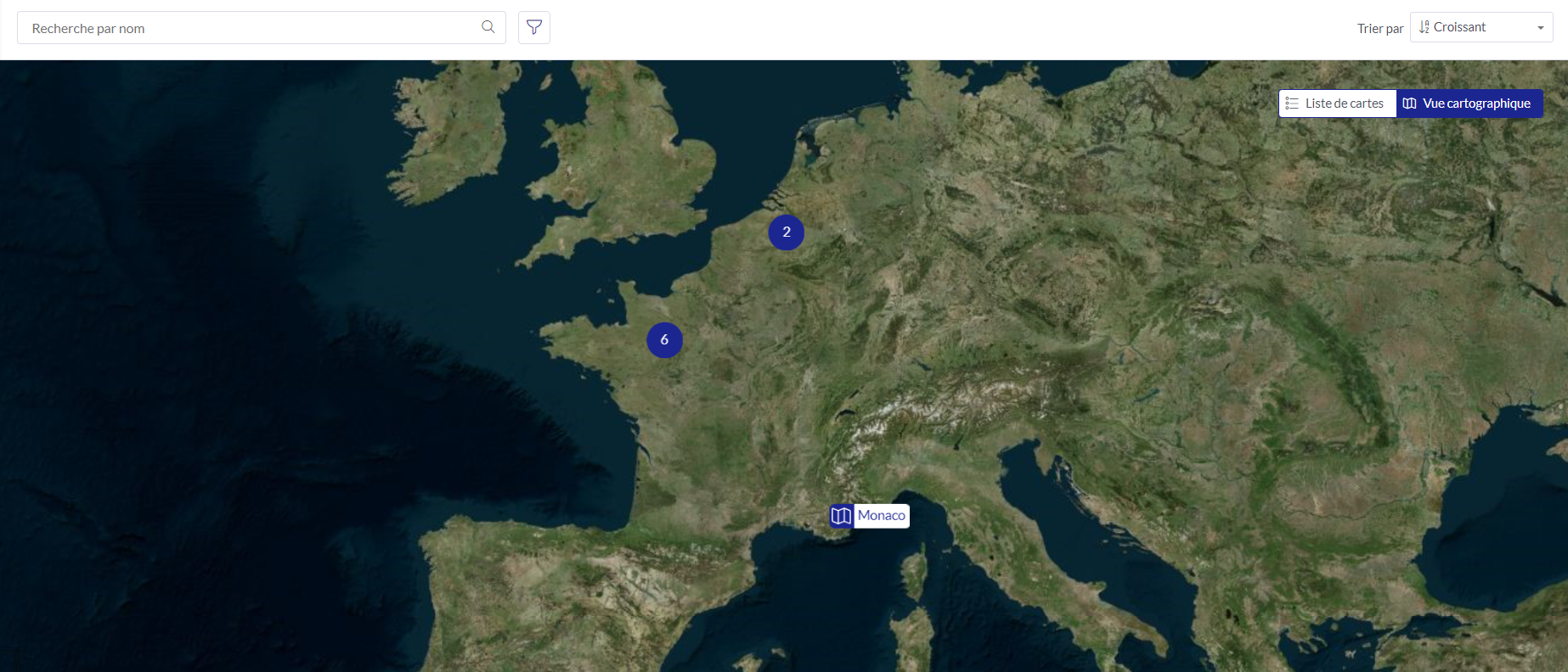
Visualisez tous les contenus sur une carte
Il est maintenant possible de géolocaliser des contenus (carte ou tableau de bord), et de la visualiser sur une vue carte (et de les rechercher par localisation).
Vidéo
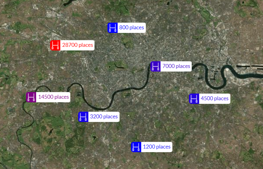
Affichage de textes
La stylisation d'une couche de points permet d'afficher des textes (fixes ou par attribut, avec ou sans icone).
Vidéo
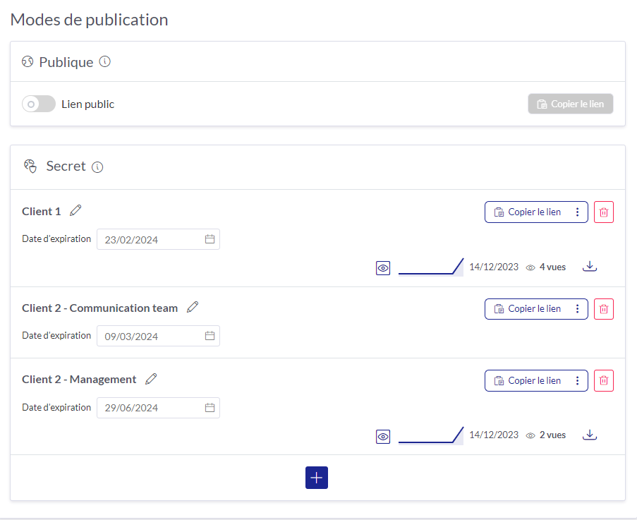
Publiez vos contenus en mode public ou secret
L'interface de publication a été revue pour simplifier la création et gestion de plusieurs liens publics ou privés, avec des statistiques de vues par lien.
Vidéo
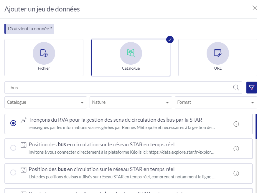
Recherche dans les catalogues
Que vous ayez référencé un seul ou de nombreux catalogues, la recherche est maintenant instantanée parmi l'ensemble de ces catalogues, grâce à une indexation. Des fonctionnalités de filtrage permettent de trouver de manière efficace les données les plus pertinentes.
Vidéo
Nouveaux traitements
Calculer des statistiques sur des points ou sur un raster de potentiel solaire par quartier, région ou tout autre polygone, ou extraire des valeurs d'un raster qualité de l'air sur des points donnés, c'est maintenant possible grâce à de nouveaux traitements disponibles dans SCE Web Application.
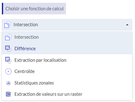
Vidéo
Statistiques zonales
Extraction d'un raster
Nouveautés sur les tableaux de bord
Un filtrage sur des polygones existants, des graphiques sur des couches raster sont désormais possibles.
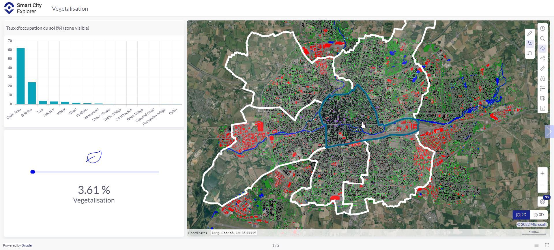
Vidéo
SCE Web Application
Story
-
[SWA-1142] - Valorize reference bbox on geocoding service call
-
[SWA-1259] - [Catalog] As a user I wish filter my catalogue results depending their type (geo, dtm..)
-
[SWA-1966] - [Navigation axis] Enhance steps display
-
[SWA-2017] - [Filters] Update filter configuration in layer configuration
-
[SWA-2040] - ✪ [Import Data] Propose a powerful search of data for catalog
-
[SWA-2417] - [Dataset edition] Store column filter when editing dataset
-
[SWA-2471] - [Folders] Store Sorting choice for a user in the folders section
-
[SWA-2616] - [Dashboard] Sync text widget with a map
-
[SWA-2743] - Allow to configure an additional attribute source from url
-
[SWA-2801] - [import] Display detailed error message when importing data from the map
-
[SWA-2828] - Propagate customised interface color to layer default configuration color
-
[SWA-2847] - [CK editor] Enable integration of video from ANY hosting
-
[SWA-2902] - [Visualization layer] Link navigation axis to visualization layer filtering
-
[SWA-2949] - [Data processing] Enable processing of extract values from raster
-
[SWA-2951] - [Data processing] Enable processing of Zonal statistics on vectors
-
[SWA-2955] - [Dataset monitoring] Add information on ressource consumption in profile settings
-
[SWA-2967] - [Dashboard] Enable to filter on existing polygon in dashboard
-
[SWA-2983] - [Dashboard] [Graph widget] Minor display enhancements
-
[SWA-3006] - [Text] Enable display of Text on scene for point layer
-
[SWA-3023] - [Data processing] Enable processing of Zonal statistics on raster
-
[SWA-3025] - [Content] Add location information for each content
-
[SWA-3026] - [Content] Enable content view on a map
-
[SWA-3028] - [Content] Enable to filter content based on location
-
[SWA-3029] - [Administration] Add a section to define default map
-
[SWA-3035] - [Data processing] Add option to add a prefix on field name when keeping attributes
-
[SWA-3076] - [public content] enable different public content sharing modes
-
[SWA-3111] - [Folders] Always fill lines with folders
-
[SWA-3126] - [Dashboard] [Media widget] enable to upload media to SCE Web App
-
[SWA-3172] - [Filter][Navigation axis] Enable to filter based on a navigation axis with double step (between)
-
[SWA-3248] - [Theme] Enable to rename default theme
-
[SWA-3259] - [Administration] Define default location
-
[SWA-3285] - [Legend] Remove ":" between color by : attribute
-
[SWA-3291] - Use attribute name for picking configuration instead of UUID
-
[SWA-3297] - [Administration] Update admin home page "overview"
-
[SWA-3299] - [Administration] Modify alternative color to align with Engie chart
-
[SWA-3313] - [popin] Link ... add Open in edition to edition in map
-
[SWA-3324] - [public content] Propose larger historic for public view monitoring
-
[SWA-3331] - [Folder] Add information on creation date, creator, ... for folders
-
[SWA-3332] - [Content] Add information on creation date, creator, ... for contents
-
[SWA-3371] - Upgrade to Angular 16.X
-
[SWA-3384] - [Edition] Enable to set offset vs ground for point layer
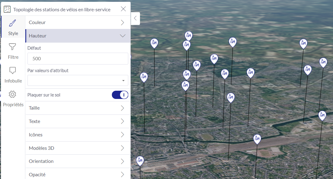
La hauteur des points est maintenant gérée par couche dans la configuration, et peut être fixée globalement, ou par valeur d'attribut.
-
[SWA-3385] - [Filter] Enable to parse existing values when filtering
-
[SWA-3390] - [Admin] Add a section to define default imagery
-
[SWA-3391] - Upgrade SWA plugin boilerplate
-
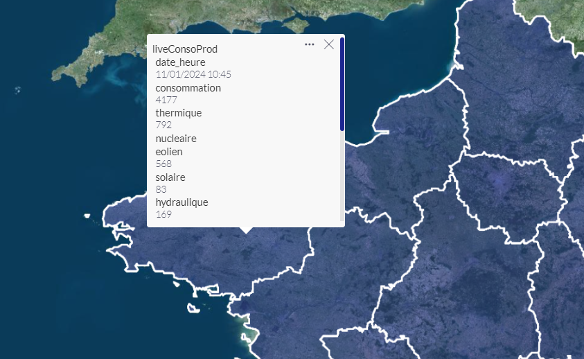
[SWA-3398] - Add support for URI of JSON content
-
[SWA-3412] - [Point] Enable to set height based on an attribute
-
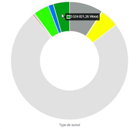
[SWA-3439] - [Dashboard] [Raster] Enable chart based on raster
-
[SWA-3443] - [Animation] Enable to inverse animation
-
[SWA-3449] - Allow to configure indexing catalogues
-
[SWA-3453] - Set by default scene date to June 21th
Par défaut, la luminosité d'une carte est maximale. L'utilisateur peut toujours ajuster la date de la scène manuellement.
-
[SWA-3457] - [Text] Enable to choose formatting for text and date attributes
-
[SWA-3458] - [Text] Enable to type text without adding it to the list
-
[SWA-3459] - [Text] Enable to create multi lines text
-
[SWA-3471] - [Data processing] Modify zonal stats attributes naming
-
[SWA-3473] - [Processing] Add pop up to indicate that processing is being generated
-
[SWA-3474] - Add secrets config and operations
-
[SWA-3481] - Allow to import additional csv attribute with different reference name
-
[SWA-3503] - Replace geocoding usage
-
[SWA-3504] - [Text] Avoid using icon contour when used in text display
-
[SWA-3518] - Update converters
-
[SWA-3523] - [Data Processing] In extract value from raster, use raster name instead of "value"
-
[SWA-3539] - [Publication] Set approbation after the link
-
[SWA-3544] - Wording update in content page
-
[SWA-3550] - [Administration] Add information and wording on map admin screen
-
[SWA-3551] - Allow to import MVT vector sources
-
[SWA-3555] - [Processing] Update processing zonal statistics description
-
[SWA-3573] - [Content] Modify content location wording
-
[SWA-3574] - [Administration] Update catalog properties screen
-
[SWA-3597] - [Legend] Align icon size in legend between icon and text + icon
Bug
-
[SWA-3156] - [IPAD]The layer list is not scrollable on an IPAD
-
[SWA-3157] - [dashboard/map widget/old map] issue when loading map in a dashboard widget
-
[SWA-3252] - data library "Toutes les natures" button issue
-
[SWA-3339] - problème d'alignement des éléments dans la légende
-
[SWA-3393] - hexagrid background color selection by number of features count generates error logs
-
[SWA-3394] - opening layer configuration panel generates errors in logs
-
[SWA-3397] - legend refresh in public view
-
[SWA-3399] - Do not display failed processed referential in computation processing
-
[SWA-3402] - Moving Referentials from a folder (not my own) to a personnal folder return an unexpected error
-
[SWA-3406] - Not expecting to edit Imagery Layer in MAP
-
[SWA-3408] - Pas de centrage suite à une creation de layer via computing
-
[SWA-3409] - Dataset creation through compute does not generate a notification
-
[SWA-3410] - Logo and broken image links
-
[SWA-3411] - Unexpected trace from legend component
-
[SWA-3413] - On the default card configuration, the radiobutton is inversed
-
[SWA-3414] - The "Edit on map" button return on the edition with the dataset no selected
-
[SWA-3416] - Draw polygon filter on scene in dashboard does not work anymore
-
[SWA-3418] - [Help page] Correct help page in standard mode
-
[SWA-3420] - Can remove my text style
-
[SWA-3421] - Color style with rainbow palette look like not working anymore
-
[SWA-3422] - When inactivate a navigation axis, the filter condition on is not disable
-
[SWA-3423] - When unused a navigation axis should be hidden on public map
-
[SWA-3424] - Selecting a 3D model doesn't work
-
[SWA-3428] - The user cannot save the clamping of polylines
-
[SWA-3438] - [Text] Propose numeric and date formatting in text configuration
-
[SWA-3446] - [Legend] Higher limit info for raster gradient is not well placed
-
[SWA-3447] - [Navigation Axis] Issue when trying to edit an navigation axis
-
[SWA-3448] - log error when opening legend with hexagrid with palette on backgroung color
-
[SWA-3450] - Can use uploaded assets on a tenant
-
[SWA-3454] - Filtering a polygon layer with a drawed polygon in a dashboard return an error
-
[SWA-3466] - Affichage en anglais des dates dans les infobulles
-
[SWA-3468] - drag and drop d'un menu dans l'application ouvre l'ajout de dataset
-
[SWA-3470] - The media preview is not displayed
-
[SWA-3472] - [Admin] When reallocating ressources, only users visible can be used
-
[SWA-3482] - I cannot delete the location information on a map
-
[SWA-3483] - [palette] On Firefox only, cursor on continuous palette cannot be moved
-
[SWA-3485] - User stats does not show user resources but accessibles resources
-
[SWA-3486] - [Palette] After multi color palette edition, one ticker appear per color
-
[SWA-3490] - [Referential] Close catalog description button is missing
-
[SWA-3497] - The text on point element is set to blank by default
-
[SWA-3498] - refresh problem on adding a text on a point layer
-
[SWA-3499] - Text on points : it is impossible to return to a point without label
-
[SWA-3507] - Going back on project after map creation does not show the created map
-
[SWA-3508] - User Stats and Admin stats are not correctly displayed
-
[SWA-3509] - Save button not enabled when editing features on the map
-
[SWA-3512] - On latest, I can not create map due to non existing defaut map (admin)
-
[SWA-3513] - I cannot create a map if a default map has been created
-
[SWA-3517] - Colorisation by floor doesn't work
-
[SWA-3520] - When using a Day step hover a 1 or 2 months range, my steps are every 2 days
-
[SWA-3521] - I can not configure my attributes order in popin display
-
[SWA-3524] - Enhance card/map display button with filtre activated
-
[SWA-3526] - [Filter] I can not with contains operator for feature filters with alphanumeric axis
-
[SWA-3529] - the style gradiant add a lot of steps
-
[SWA-3531] - Narration is not up to date with the viewpoint text
-
[SWA-3532] - Edition of Dashboard publication configuration does not work
-
[SWA-3533] - Custom theme for dashboard not working for all colors
-
[SWA-3535] - Unexpected "Undefined" text value with Text styles
-
[SWA-3536] - I can t make private link when the publication control is activated
-
[SWA-3537] - [Legend] Legend is not totally visible at 100% zoom
-
[SWA-3541] - The group picture return to the default one when adding a user
-
[SWA-3543] - I can see some dashboard in map content view
-
[SWA-3553] - No adress search in a map
-
[SWA-3554] - The attribute popin cannot be dispayed alphabetically
-
[SWA-3558] - After a publication, the top menu is not available
-
[SWA-3564] - [Text] Attribute selection is open by default up to the top and partly hidded
-
[SWA-3568] - Not possible to add a glb file from an URL
-
[SWA-3569] - [Wording] Update wording on processing
-
[SWA-3570] - [Processing] Zonal statistics on raster only computed mean
-
[SWA-3572] - Building import with texture and CSV
-
[SWA-3583] - [Catalog] Column label is larger than column in advanced informations
Task
-
[SWA-3263] - [Content] Implement User filter for resource list
-
[SWA-3265] - [Content] Add more option for the public status of resource filter
-
[SWA-3382] - Upgrade ckeditor and @ckeditor/ckeditor5-angular
-
[SWA-3392] - Incomplete configuration on computed processing edition
-
[SWA-3415] - remove google fonts get requests
-
[SWA-3460] - Allow import of raster terrain tiles
-
[SWA-3465] - use theme colors on routing, geocoding and edition
-
[SWA-3479] - Zonal statistic with raster, allow only stats on value (exclude pixel, surface)
-
[SWA-3502] - Use chrome / chromium lighthouse report and improve
-
[SWA-3519] - When text activated on a point layer, use icon without border
-
[SWA-3561] - [Profile settings] Inverse activity with customization
SCE Web Core
Story
-
[SCEWEB-2240] - Add management for temporary access key for resources (scene/dash)
-
[SCEWEB-2366] - Allow to provide a scene object to a scene component
-
[SCEWEB-2377] - Create and populate catalogue from API
-
[SCEWEB-2384] - Complete Dashboard exported by the resource-loader module
-
[SCEWEB-2398] - [Data processing] Enable processing of Zonal statistics on raster
-
[SCEWEB-2401] - Upgrade to OL > 7.4
-
[SCEWEB-2408] - Allow to manage as dataset big source of geotif raster
-
[SCEWEB-2411] - Check validity of aggregate expressions
-
[SCEWEB-2414] - Reduce precision of coordinates in tiles
-
[SCEWEB-2424] - Refactor of catalog-mgt think "Data Search" ( catalog proxy, content indexer)
-
[SCEWEB-2428] - Add cache on raster-mgt
-
[SCEWEB-2431] - As a user I want to be able to filter resource on Public state, so that I can find the data easily
-
[SCEWEB-2443] - User list api: allow sort on roles and groups
-
[SCEWEB-2445] - cache control public/private override not applied on att-set-management
-
[SCEWEB-2450] - Add used assets management on resource-loader export/import
-
[SCEWEB-2451] - Upgrade to HRZ 23.3.0
-
[SCEWEB-2452] - Upgrade to Angular 16.X
-
[SCEWEB-2479] - Move BrowserSupportService in sceweb-api module
-
[SCEWEB-2482] - Allow to store text style configuration on layer
-
[SCEWEB-2483] - Allow to display text/text panel for points on OpenLayers
-
[SCEWEB-2502] - Allow to configure prefix for attributes in computation processing request
-
[SCEWEB-2508] - expose project,scene,dashboard lists as geobuf
-
[SCEWEB-2509] - Support picking event on Geometry API
-
[SCEWEB-2510] - Use heading for icons on Horizon
-
[SCEWEB-2511] - Use symbols to display points on Horizon
-
[SCEWEB-2513] - Load attributes by tile on Horizon
-
[SCEWEB-2514] - Allow to display text/text panel for points on Horizon
-
[SCEWEB-2516] - Support texts on Geometry API
-
[SCEWEB-2519] - [point] Define point height in configuration
-
[SCEWEB-2520] - Use custom font on OpenLayers
-
[SCEWEB-2528] - Add import of MVT tiles as vector
-
[SCEWEB-2529] - Complete support of MVT vector tiles source on client with default style application
-
[SCEWEB-2537] - Add location property on resources (project, scene, dashboard)
-
[SCEWEB-2538] - [Text] Feedbacks on text in 2D
-
[SCEWEB-2540] - Enable processing of extract values from raster
-
[SCEWEB-2541] - Add ConditionByAttributes comparing globalValue with an expression
-
[SCEWEB-2546] - Add FormatStyleConfiguration
-
[SCEWEB-2553] - integrate scetools geocoding service
-
[SCEWEB-2554] - Manage visual configuration of resources with resource-loader
-
[SCEWEB-2561] - Stop using unnecessary attributes on Horizon
-
[SCEWEB-2562] - Enhancement of referential additional attributes import
-
[SCEWEB-2564] - [Horizon] Modify Horizon default color
-
[SCEWEB-2570] - Clusterize points in geometry collections on OpenLayers
-
[SCEWEB-2580] - Allow to filter scene, dashbrd.. list as geobuf with tags
-
[SCEWEB-2582] - Add name for secret links
-
[SCEWEB-2588] - Upgrade to OpenLayers 8.2.0
-
[SCEWEB-2590] - [Processing] Remove "Keep 0 attribute" from extract values from raster
-
[SCEWEB-2608] - [Map] Enable to smooth atmosphere effect on scene
Bug
-
[SCEWEB-2498] - remontée d'information sur un import en erreur trop floue
-
[SCEWEB-2506] - Processing of ExtractionComputationConfig not working with count(*)
-
[SCEWEB-2527] - Previous jwt token still used in HRZ requests after a refresh token
-
[SCEWEB-2556] - Improve exception management in computation service
-
[SCEWEB-2565] - [User Metric] User metrics do not split the owned ones by the user and the shared correctly
-
[SCEWEB-2568] - [Zonal Computation] Prefix for extractionSourceAttributes is not taken into acount
-
[SCEWEB-2572] - The migration container does not work anymore
-
[SCEWEB-2577] - Error on IconInSvg
-
[SCEWEB-2581] - Display not updated when receving geometry updates by websocket
-
[SCEWEB-2585] - Unexpected stacktrace on SWA latest server
-
[SCEWEB-2587] - OL does not use max available resolution for raster display
-
[SCEWEB-2593] - Setting weight on StyleConfigurations of heatmap doesn't work
-
[SCEWEB-2595] - Unexpected stacktrace on GET metrics/usage/all
-
[SCEWEB-2596] - Hexagrid is not displayed on OL but ok on HRZ
-
[SCEWEB-2598] - Points positions supposed to be updated
-
[SCEWEB-2603] - [Text] Text appears with transparency
-
[SCEWEB-2604] - Test url ignoring case
-
[SCEWEB-2609] - Cannot hide / show a building layer in horizon
-
[SCEWEB-2611] - [Text] Padding is different if there are only one character to display
-
[SCEWEB-2612] - No text on points in 3D mode
Task
-
[SCEWEB-2523] - Upgrade BC (23.2.1) and RT (23.1.1)
-
[SCEWEB-2550] - Remove TC docker, and processing
-
[SCEWEB-2551] - Perform URL check during referential processing
-
[SCEWEB-2567] - Integrate HRZ 23.3.1
-
[SCEWEB-2583] - Upgrade converters
-
[SCEWEB-2592] - Remove hook related to HRZ 23.3.2
-
[SCEWEB-2594] - Upgrade to HRZ 23.3.2